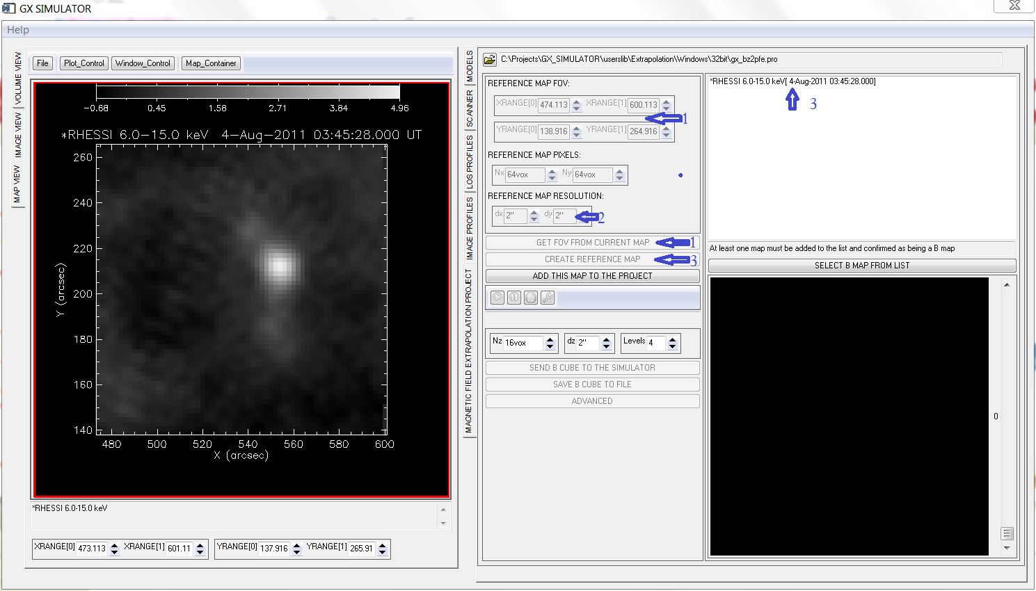
An already imported map, whether or not is a photospheric
magnetic field map, may be used to create an Extrapolation
Project Reference Map by following these steps:
-
Select the desired field of view FOV either by
directly typing into the XRANGE and YRANGE
numerical imput fields, or by using the mouse tool for zoomin into the
original map, if necessary, followed by pushing the GET FOV FROM
CURRENT MAPbutton.
-
If needed, change the original map resolution to a
desired figure using the dx and dy numerical
input fields.
-
Push the CREATE REFERENCE MAP button to validate the selected FOV and Resolution and create a
Reference Map that is added on top of the Project Map
List
.

 Creating a Reference Map

 Creating a Reference Map
